

Ready to trade traffic for tree cover, skyline views, and a better day outside? Atlanta's Most Scenic Walking and Biking Trails give you that reset, whether you want a lively urban ride, a shaded creekside walk, or a longer paved route that feels far from the city even when you're still inside metro Atlanta. If you're mapping out a route, keep this puppy leash training tips article handy if you're bringing a dog, because shared trails work best when everyone stays predictable and courteous.
Table of Contents
- 1. Atlanta BeltLine Eastside Trail
- 2. Atlanta BeltLine Westside Trail
- 2. Atlanta BeltLine Westside Trail
- 3. Silver Comet Trail
- 4. Arabia Mountain PATH (AMP)
- 5. Stone Mountain Trail (PATH Foundation)
- 6. Big Creek Greenway
- 7. Chattahoochee River National Recreation Area, Cochran Shoals and Sope Creek
- Comparison of Atlantas Top 7 Scenic Trails
- After Your Ride, Responsible Recycling in Smyrna
1. Atlanta BeltLine Eastside Trail
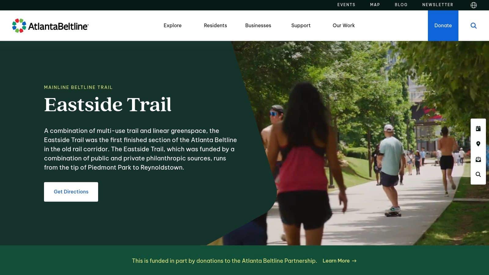
The Eastside Trail is the trail first-time visitors picture when they think about Atlanta on foot or by bike. It is paved, easy to follow, and built for constant movement between parks, dining, markets, and transit, which makes it feel less like a stand-alone path and more like a stitched-together slice of the city. For a broader planning perspective, see a complete BeltLine visitor guide. The BeltLine also frames it as part of a larger network that is already being expanded well beyond today's footprint, with the 2025 Trails ATL plan calling the existing city network 80 miles and projecting 420 miles of new trails overall by 2052, enough to push access far beyond what most cities can claim today. Trails ATL report
Why it works for first-time visitors
This is the trail for people who want energy, visibility, and easy logistics. You can start near Piedmont Park, detour to Ponce City Market, stop at Krog Street Market, and still feel like you've stayed on one continuous route rather than cobbling together a map from scratch. The BeltLine's own Eastside Trail page emphasizes access points, lighting, and wayfinding, which matters when you want a route that is straightforward to follow and easy to exit if your plans change.
That practicality matters for more than sightseeing. If you are putting together a relaxed Atlanta day, the Eastside Trail lets you combine walking or biking with food stops, quick transit connections, and shorter out-and-back sections that do not require a full commitment to a long ride. It also works well for visitors who want a clear, urban route without guessing where the next crossing or trailhead will be.
The trade-off is crowding. Peak hours can slow the pace, especially near the busiest destinations, so expect a social trail rather than a quiet one. If you want to avoid feeling boxed in, go earlier in the day or use the trail for a point-to-point trip instead of trying to cover the whole corridor at once.
2. Atlanta BeltLine Westside Trail
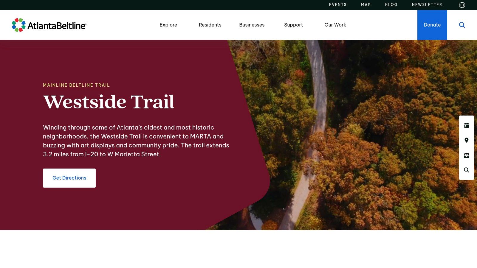
The Westside Trail gives the BeltLine a different feel. The route runs through neighborhoods, parks, pocket art, and older industrial spaces, so the scenery shifts without the constant storefront pressure you get on the Eastside. It also sits within a larger system that is still being built out, and that matters here because route choices can change as new segments open and connections improve. Eastside Trail details
What feels different on the Westside
This is the better choice when you want more breathing room. Longer stretches let you settle into a steady pace, and the mix of greenery, public art, and residential edges gives the trail a calmer rhythm than the busier east side. For walkers and cyclists who care more about the route itself than a long list of retail stops, that lower-key setting is a real advantage.
The trade-off is practical. There are fewer built-in places to stop for water, snacks, or a quick reset, so you should plan ahead instead of assuming everything you need will be right on the trail. That makes the Westside a smart pick for riders who like a quieter corridor and do not mind carrying a little more with them. If you want to pair the outing with other local plans, it also works well alongside weekend adventures near Atlanta, especially when you are already mapping out a fuller day in the city.
For visitors who want a practical, less crowded BeltLine experience, the Westside is a strong option. It feels more residential, more open, and a little easier to ride without stopping every few minutes. That said, it rewards preparation, since the reduced retail density means you should think through parking, water, and your exit route before you start.
2. Atlanta BeltLine Westside Trail
The Westside Trail gives you a different version of the BeltLine. It feels greener and more residential, with longer stretches where you can settle into a rhythm instead of constantly reacting to storefronts and cross-traffic. National Geographic notes that the BeltLine had reached almost 16.4 miles after the addition of two miles, and that the northern section is scheduled for completion by 2030. That staged buildout matters here because the Westside keeps changing in real time, which is part of its appeal and part of why route planning still deserves attention. National Geographic on the BeltLine
What feels different on the Westside
This is the better choice when you want more breathing room. The corridor runs through neighborhoods, parks, pocket art, and industrial legacy spaces, so the scenery changes without feeling disjointed. It's also a useful route if you care more about the actual ride than the stop-and-go retail environment, because there are longer uninterrupted stretches and fewer built-in distractions than on the Eastside. For first-time visitors, the Eastside Trail is the trail they usually picture first when they think about Atlanta on foot or by bike, while the Westside asks you to focus on pace, space, and the route itself.
The downside is practical, not aesthetic. Fewer on-trail retail stops means you should plan water, snacks, and a return route before you roll out. Construction detours can also appear as new segments are added, which is the normal cost of a corridor that's still being built into its full shape. If the Eastside feels like a social promenade, the Westside feels more like a ride you can settle into.
The Westside rewards people who value continuous movement over constant activity. That's why longer rides and longer walks tend to feel easier here, even when the route is just as scenic.
The BeltLine's broader regional context helps explain why this trail matters. Metro Atlanta already has nearly 400 miles of trails, split between 245 miles of local trails and 153 miles of trails of regional significance according to the Atlanta Regional Commission. That kind of network makes the Westside feel like part of a real transportation system, not just an isolated amenity. ARC trails report
For people building out a full day, the Westside also pairs well with top hiking trails near Atlanta and with weekend adventures near Atlanta, especially when the trail is only one part of a longer plan.
3. Silver Comet Trail
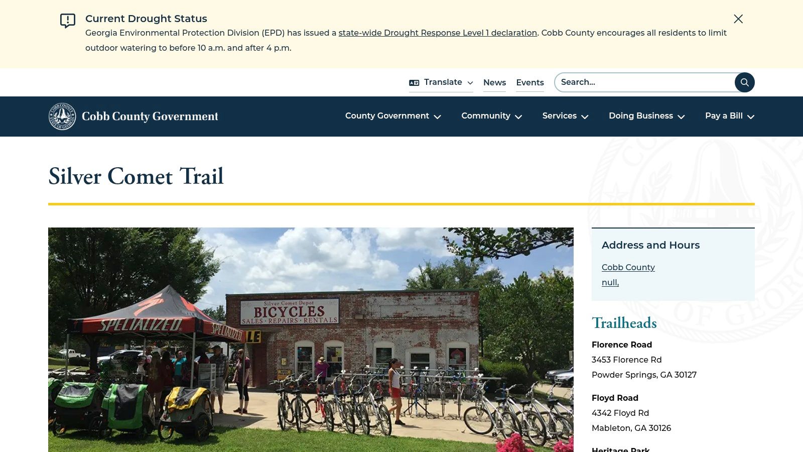
The Silver Comet Trail is the straightforward choice for anyone who wants a long paved ride with less friction. It's a 61.5-mile rail-trail about 13 miles northwest of Atlanta, and the official trail site says it runs through Cobb, Paulding, and Polk counties. It's free, non-motorized, and open to walkers, hikers, bicyclists, rollerbladers, horses, and dog walkers, with much of it wheelchair accessible. That mix makes it one of the strongest all-day trail options in the region. Silver Comet Trail official site
How to make a long ride easier
The biggest advantage of the Silver Comet is the surface. It's paved, mostly flat, and off-road, so it works well for family rides, steady training days, and anyone who wants to avoid traffic or technical terrain. The trail begins at the Mavell Road Trailhead in Smyrna and ends at the Georgia-Alabama state line near Cedartown, where it connects to the Chief Ladiga Trail, so you can use it for a short outing or a much longer mileage day depending on your legs and schedule.
Logistics matter here more than scenic hype. Parking near Smyrna can fill early on weekends, and water or food stops can be spaced farther apart than you might expect, so pack what you need before you roll out. That is the trade-off for a long corridor that stays calm and usable across so much distance.
If you are planning a trail day around errands, Smyrna makes this route especially practical. A ride on the Silver Comet can pair naturally with a stop at Beyond Surplus's Smyrna area service location, which is useful if you are already thinking about secure electronics recycling or IT asset disposal for the office. It also fits well with planning around family-friendly outdoor attractions in metro Atlanta or other outdoor time nearby, since the trail day can be one part of a broader stop-and-go itinerary without adding much extra drive time.
If you want a smooth trail day, start early, bring water, and assume the next restroom or snack stop may be farther away than you think.
4. Arabia Mountain PATH (AMP)
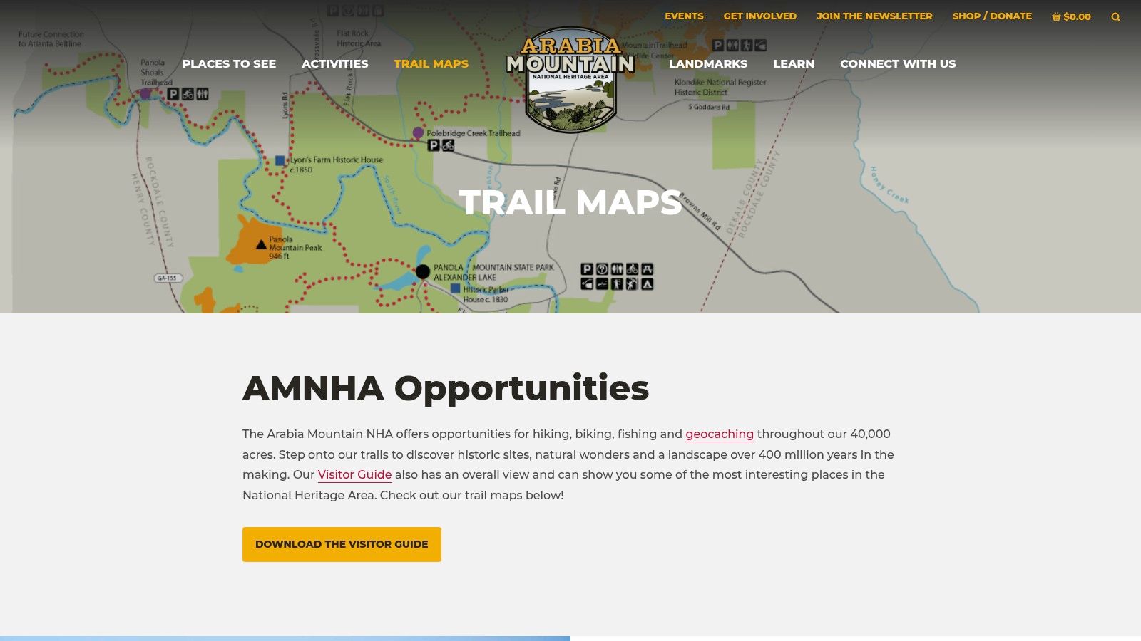
Arabia Mountain PATH is the better pick if you want the scenery to keep shifting. The trail network spans 20+ miles and moves through granite outcrops, lakes, meadows, and historic sites in the Arabia Mountain National Heritage Area, which gives it a more varied feel than the city-center trails. It also connects to nature centers and Panola Mountain, so the route suits a day out that feels tied to the land rather than the built environment. Arabia Mountain PATH maps
Best for scenery variety
The scenery changes quickly here. One stretch may be a paved greenway, and the next puts you in front of granite domes, wildflowers, or open water, so the route avoids the repetitive feel that some trails can have. Families can choose shorter segments, while riders and walkers looking for more distance can piece together longer fitness outings.
There is a trade-off. Some sections include short, steep rollers, so this is not the easiest place for someone who only wants a flat cruise. Retail on the trail is limited too, which means water and snacks should go in the car before you leave. For people who care more about visual variety than convenience, that is a fair trade.
The layout also works well for cyclists who want a planned ride without the crowding you sometimes get on Atlanta's busiest urban corridors. Multiple trailheads make it easier to build a loop instead of committing to one long out-and-back, and that flexibility is part of why the area keeps showing up on local trail lists. For a broader set of low-cost outing ideas around the city, see free things to do in Atlanta on a budget.
Best use case: choose AMP when you want one outing with granite, forest, and water views instead of the same backdrop the whole time.
5. Stone Mountain Trail (PATH Foundation)
The Stone Mountain Trail is one of Atlanta's clearest city-to-nature corridors. PATH Foundation describes it as a roughly 19-mile route linking Centennial Olympic Park to Stone Mountain Village and into Stone Mountain Park, using paved paths and sidepaths that let you move from downtown energy into a much more natural setting. That makes it a strong choice for riders or walkers who want a destination, not just a loop. Stone Mountain Trail details
What to watch for near the park
The route's biggest strength is also the part that requires the most attention. It creates a memorable ride, but some roadside stretches include driveways and intersections, so riders and walkers need to stay alert here more than they would on a fully separated greenway. Once you're inside Stone Mountain Park, the rules change again, bikes are allowed on roads and the PATH, but not on hiking trails or the granite walk-up trail.
That detail matters for planning. If you want a smoother visit, use the trail as your approach into the park instead of trying to treat every park path the same way. The payoff is practical as well as scenic, bicyclists and pedestrians can enter the park from the trail without paying vehicle entry fees, which makes the route a useful option for a low-friction day trip.
The scenery also changes in a way that makes the miles feel more interesting. You get urban views, older neighborhoods, and then the lake-and-forest setting that makes the route feel longer than the map says. For many people, that transition is the point. The city does not stop abruptly, it gradually gives way to the park.
If you are planning a full day around the trail, it also pairs well with other nearby outings that fit family-friendly outdoor attractions in metro Atlanta. That makes it easier to build a plan around a walk, a ride, and a simple stop without having to cross town again.
6. Big Creek Greenway
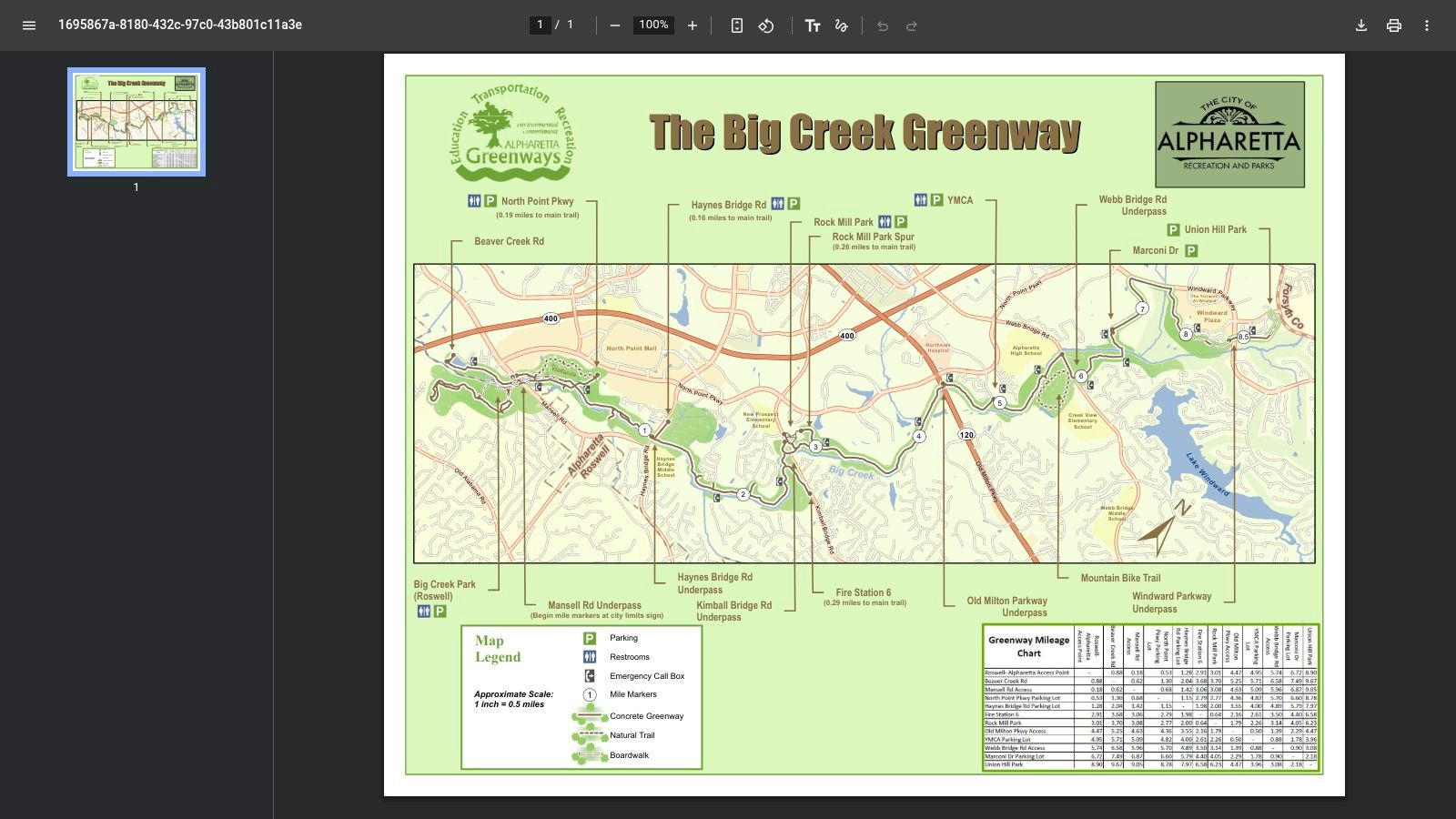
Big Creek Greenway is the trail you choose when shade and calm matter more than pace. The Alpharetta and Roswell sections form a paved creekside corridor with boardwalks, wetlands, and wooded stretches, and the trail map highlights multiple trailheads, rest areas, and clear mileage markers. That makes it one of the easier Atlanta-area trails to use without building a complicated plan around the day. Big Creek Greenway map
Why shade matters here
This trail works well for casual rides, stroller walks, and anyone who wants a flatter route with less exposure. The tree cover and wetland setting create a quieter kind of scenic experience, one that feels different from a skyline trail and far less exposed than a road-adjacent corridor. If you want to move at an easy pace and still feel like you've gotten outside the city, this route fits that plan well.
There are practical trade-offs to keep in mind. Boardwalks can be slick after rain, and some sections may close following heavy weather, so it is smart to check conditions before heading out. If your group wants variety, Big Creek Park also gives mountain bikers a dirt option while others stay on the paved greenway.
Best fit for the Greenway: walkers who want fewer distractions, cyclists who prefer flatter terrain, and families who want an easy entry point into Atlanta-area trail time.
The area also helps on days when you want a low-decision outing. You are not here to spend time hopping between stops. You come here to move through trees, water, and boardwalk sections without a lot of extra planning, and that makes it a practical choice for a quiet half-day.
If you are building a budget-friendly outing around the trail, free things to do in Atlanta on a budget is a useful place to start. It fits the same low-friction approach that makes Big Creek Greenway appealing.
Choose this route when you want a predictable trail day, not a packed schedule.
7. Chattahoochee River National Recreation Area, Cochran Shoals and Sope Creek
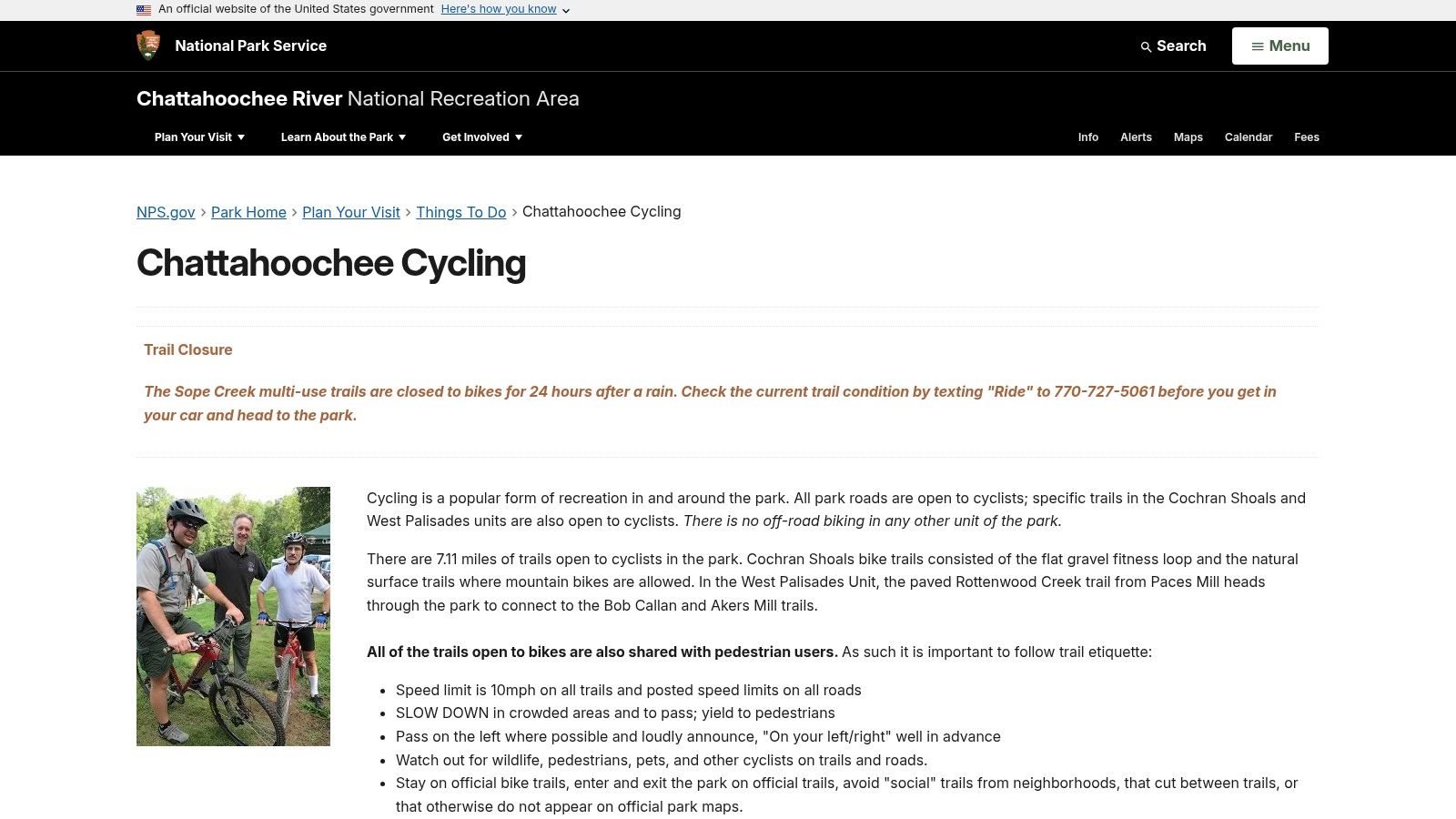
If you want river scenery close to the city, Cochran Shoals and Sope Creek are hard to beat. The National Park Service groups them within a larger river corridor that includes 15 park units along 48 river miles, and its cycling guidance makes clear where bikes are permitted. That matters because the area combines flat gravel, signed multi-use paths, and mountain-bike terrain in a way that rewards careful route choice. NPS cycling guidance
Mixed-surface choices close to the city
Cochran Shoals is the easier starting point if you want a flat gravel fitness loop with river views and plenty of shade. Sope Creek adds more variety, with trails that connect to Rottenwood Creek and Bob Callan, plus mill ruins and floodplain forest scenery that make the area feel more layered than a typical greenway. If you ride a gravel bike or hybrid bike, the mix of surfaces is part of the appeal.
The caution here is simple and important. Not every trail in the area allows bicycles, so you have to follow posted signs and the NPS maps instead of assuming every connector is open. Parking can also fill on pleasant weekends, which means early arrival is the easiest way to keep the day low-stress.
This is one of the best trail systems for people who want a nature experience without driving far outside Atlanta's orbit. It's not the flashiest route on this list, but it may be the most useful if your priority is quiet water views, shaded walking, and the option to vary terrain without leaving the metro area.
Comparison of Atlantas Top 7 Scenic Trails
| Trail | 🔄 Implementation complexity | ⚡ Resource requirements | 📊 Expected outcomes | 💡 Ideal use cases | ⭐ Key advantages |
|---|---|---|---|---|---|
| Atlanta BeltLine Eastside Trail | Moderate–high: urban infrastructure, lighting, art installations | High: ongoing maintenance, landscaping, security, transit integration | High foot traffic; lively urban experience and frequent stops | Short social outings, dining/shopping access, photography | Easy access to amenities; strong public art and transit links |
| Atlanta BeltLine Westside Trail | Moderate: long continuous construction and park connections | Moderate–high: corridor upkeep, park/landscape care, wayfinding | Longer uninterrupted rides; quieter than Eastside | Extended rides, neighborhood connections, park visits | Longer stretches for fitness; mix of nature and neighborhood scenery |
| Silver Comet Trail | Low–moderate: rails-to-trails conversion, simple paved corridor | Moderate: long-distance maintenance, trailheads parking and restrooms | Long-distance, gentle grades; family- and endurance-friendly | Endurance rides, long family outings, car-accessed trailheads | Extensive mileage and shade; very accessible surface and grades |
| Arabia Mountain PATH (AMP) | Moderate: boardwalks, bridges, heritage-area coordination | Moderate: trail upkeep, signage, site preservation | Scenic, varied landscapes; visitor-oriented interpretation | Nature viewing, curated cycling itineraries, mixed-length rides | Distinct granite scenery and curated "must-see" stops |
| Stone Mountain Trail (PATH Foundation) | Moderate: multi-jurisdiction coordination; road-side segments | Moderate: wayfinding, intersections management, park coordination | City-to-park destination rides; mixed urban/natural scenery | Destination rides to Stone Mountain; combined urban/nature trips | Direct park access without vehicle fees; memorable destination route |
| Big Creek Greenway | Low–moderate: boardwalks and wetland-sensitive construction | Moderate: boardwalk maintenance, drainage, signage | Calm, shaded corridor ideal for casual recreation | Family rides, strollers, runners, local recreational use | Shaded, well-maintained path with clear maps and access points |
| Chattahoochee River NRCA – Cochran Shoals/Sope Creek | Moderate: mixed-surface management, NPS permitting | Moderate: trail stewardship, signage, parking management | Scenic riverfront experience; mixed gravel and natural surfaces | Gravel/hybrid rides, nature walks, short fitness loops | Close-to-city river scenery; clear NPS guidance on bike-allowed routes |
After Your Ride, Responsible Recycling in Smyrna
A good trail day in Atlanta usually ends with two thoughts, one about where you rode, and another about what you'll do next time. If your route took you toward Smyrna, the Silver Comet makes a practical pairing with a stop at Beyond Surplus, especially for businesses that need a better answer for old laptops, networking gear, phones, and other IT equipment sitting in storage. That turns a scenic outing into a useful errand, and it keeps more material moving into proper recycling channels instead of back into the office closet.
The bigger point is simple. Atlanta's trail system is increasingly about mobility, access, and long-term city planning, not just recreation. The 2025 Trails ATL plan says only about 37% of Atlantans currently have 10-minute access to an all-ages, all-abilities trail, while the full buildout projection reaches 94% by 2052. Trails ATL report That kind of long-term thinking lines up with responsible business practices, including electronics recycling, secure IT asset disposal, and better chain-of-custody handling.
For companies, the practical takeaway is straightforward. If your team is already in the Smyrna area for a ride, it's an easy time to handle equipment removal, especially if you're coordinating office refreshes, IT relocations, or end-of-life hardware disposal. Beyond Surplus serves business customers with electronics recycling and secure asset disposition services, which makes it a relevant local option when trail time and facility errands happen to land on the same day.
If your business needs secure electronics recycling, IT asset disposal, or help clearing out old technology after a stop near the Silver Comet, visit Beyond Surplus to plan a compliant pickup or drop-off. Their team can help organizations handle end-of-life equipment with documented recycling and data destruction, which fits naturally with a day spent thinking about cleaner, smarter use of Atlanta's shared spaces.


